HD Mapping
Delivering next-generation HD maps with highly accurate street mapping & localization

Challenges of Turnkey HD Maps
For building a safe self-driving technology, you need high-quality HD maps for precise navigation that are updated regularly.
While HD map companies offer off-the-shelf solutions for this, you can’t edit or update maps because the maps belong to the companies.
Building your maps in-house can be time-consuming. HD map companies will take a long time to update these maps or add new regions.
HD Mapping Expertise
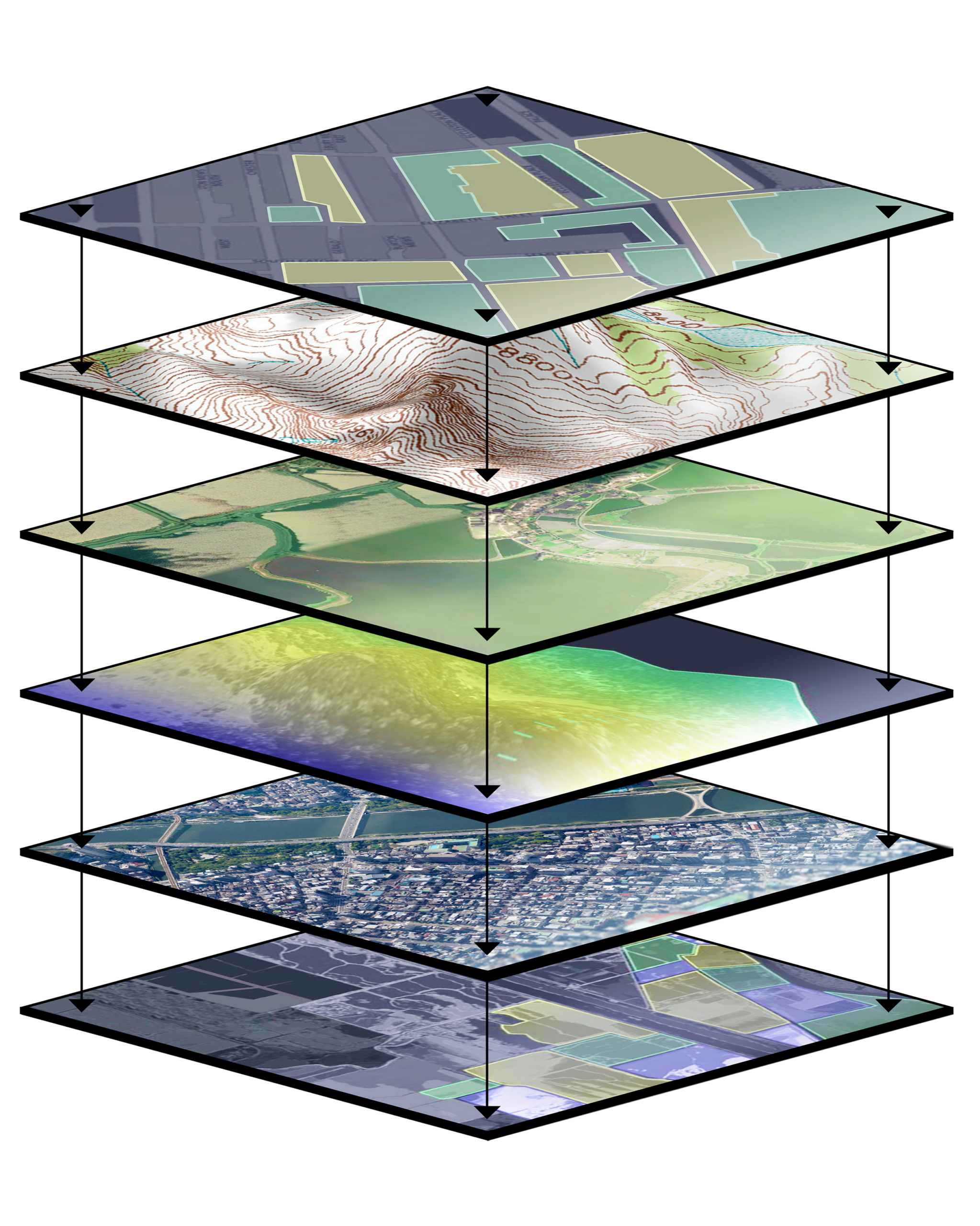
iMerit’s data experts develop and update high-definition maps to provide a high-quality, scalable, and flexible mapping solution to autonomous vehicle companies.
Our team of 1,100 data annotators with mapping expertise helps process static environment and real-world information into a series of highly accurate layers.
With our 10+ years of experience in HD mapping for self-driving technology, we have built custom workflows on a wide range of tools.
Delivering Precise HD Maps
We are the leader in building and labeling of HD maps for autonomous vehicle companies.
- 3/5 Top Autonomous Vehicles companies work with us for our expertise and Human-in-the-loop model.
- Rapid scalability with our agile teams that adopt a transformative and solution-based approach to address your project needs.
- Custom workflows, with 2-step production and quality assurance, will be aligned with your business processes and project needs.
- We are tool-agnostic and can offer our proprietary data annotation technology or work on your or any other 3rd-party tools.
- Our expert data annotators with domain knowledge undergo specialized training for edge case resolution.
- Quick-start labeling guidelines and real-time quality reporting.
Common Use Cases
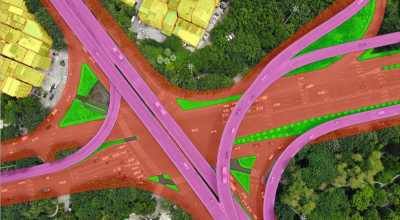
Semantic Mapping
Ground truth semantic labels for features, including lane markings and road segments on dense point cloud maps
Road rules
Updating and maintaining a constantly changing database of road rules based on different state traffic laws
Issue Triage & Resolution
Creating triage for re-drive on areas for getting more data and resolving issues or updating the map based on those
Live Map
Round-the-clock support to keep the map updated at all times
Route Creation
Training autonomous vehicles to analyze several routes and choose the most efficient path from point A to point B
Road Features & Conditions
Annotating and labeling semantic features like traffic lights, road signs, and various road conditions
Case Study
Improving Ground Truth Data for A Global Robotaxi Company
A leading Robotaxi company works with iMerit to improve ground truth data to enhance its self-driving technology. Previously, the company was working with large-scale auto-labeling players but the quality was not satisfactory.
The initial project for the Robotaxi company was on LiDAR and 2D segmentation, and now the iMerit team is helping with scene hunting and masking scenarios.
With 95% annotation accuracy and 250% improvement in efficiency, the Robotaxi company could improve the quality of raw production data for improved ML model performance.
"As we're constantly navigating and adapting to challenges, iMerit has always been a dependable partner alongside us."
Product Ops Manager, Top 5 AV Company


Download Solution Brief