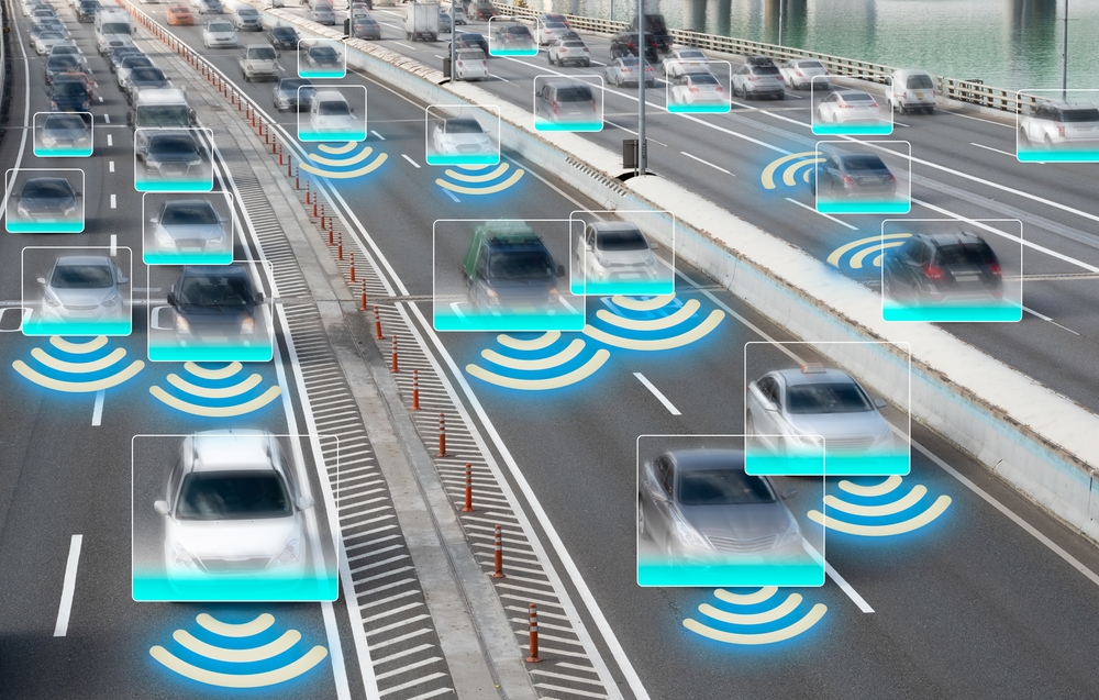
Autonomous vehicles are only as intelligent as the data that shapes them. At the heart of their perception systems is a stream of spatial data from LiDAR—millions of laser points forming a live, detailed map of the physical world. This isn’t just visual information. Its depth, distance, shape, and motion packed into dense point clouds. But raw data has no value until it’s structured. To make sense of millions of points—and teach a machine how to react to them—every scan needs expert labeling. That’s where LiDAR annotation makes the difference between guesswork and real-world performance.
What is LiDAR and How Does it Work in Autonomous Vehicles?
LiDAR—Light Detection and Ranging—is a remote sensing method that uses laser pulses to measure distances to surrounding objects. Mounted on autonomous vehicles, LiDAR sensors emit rapid bursts of laser light in all directions. When these pulses hit objects like buildings, signs, vehicles, or pedestrians, they reflect back to the sensor. The system then calculates the distance based on the time it takes for the light to return.
The result is a 3D point cloud: a high-resolution spatial map that gives AVs a real-time understanding of their surroundings, including the exact location, shape, and size of nearby objects. LiDAR data is resilient to lighting changes and functions reliably in both day and night conditions, making it a foundational layer in the perception stack of most autonomous driving systems.
Why LiDAR Data Needs Annotation
Trains Object Detection Models
Machine learning models can’t interpret point clouds on their own. Annotated data teaches them what patterns correspond to specific objects. It enables object recognition systems to identify and differentiate between road signs, vehicles, cyclists, and other elements in the driving environment.
Enhances Scene Segmentation
Scene segmentation requires breaking down the LiDAR point cloud into discrete regions—like road surfaces, sidewalks, vegetation, or dynamic objects. Without labeled data, models can’t accurately separate or prioritize these regions, leading to misinterpretations that compromise driving decisions.
Improves Trajectory Prediction
AVs don’t just need to know what’s around them—they need to predict how those elements will move. High-quality annotation tracks objects over time, providing temporal data that trains models to forecast behavior, such as a car changing lanes or a pedestrian stepping off the curb.
Supports Path Planning
Path planning relies on a clear model of drivable space. Annotations help identify lane boundaries, obstacles, and safe zones. Without this data, route selection becomes unreliable, increasing the risk of navigation errors.
Key LiDAR Annotation Techniques Used in AV Development
3D Cuboid Annotation
3D cuboids encapsulate objects in a point cloud with bounding boxes that define their position, dimensions, and orientation. This is critical for identifying vehicles, cyclists, and static obstacles, enabling the vehicle to maintain safe distances and navigate traffic.
Semantic Segmentation
Each point in the cloud is labeled with a class, such as “road,” “vehicle,” or “tree.” Semantic segmentation helps models build a pixel-level—or in this case, point-level—understanding of their environment. This fine-grained labeling supports nuanced decision-making in complex road scenarios.
Instance Segmentation
This technique takes segmentation further by distinguishing between individual instances of the same object class. For example, it allows an AV to recognize not just “pedestrian” but “pedestrian A” and “pedestrian B,” each with separate paths and behaviors.
3D Landmark Annotation
Specific reference points on objects—such as wheel centers on vehicles or body positions of pedestrians—are marked within the point cloud. It enables precise pose estimation and improves the accuracy of motion prediction models.
Polygon Annotation
Complex objects with irregular shapes, such as logos, signboards, or various human postures, are outlined with polygons to create accurate object boundaries within the point cloud.
Polyline Annotation
Road lanes, curbs, and guardrails are traced with polylines to give the AV’s path-planning system highly accurate guidance for navigation and lane-keeping.
Choosing LiDAR Annotation Services for AV
Prioritize Accuracy Over Speed
In safety-critical applications like autonomous driving, annotation errors can lead to cascading failures in the model. Work with annotation providers that emphasize multi-stage QA workflows and validation by experts.
Look for Scalable Workflows
AV development requires massive volumes of annotated data. Choose partners with solutions that scale annotation projects efficiently without compromising quality. The right annotation partner can develop a customized end-to-end workflow for fine-tuning your AI model.
Ensure Domain Expertise
Not all annotations are equal. AV projects benefit from domain experts trained in interpreting LiDAR data and familiar with driving environments, traffic laws, and edge-case scenarios.
Expert-led annotation ensures the training data is accurately labeled with AV-specific knowledge.
Leverage Human-AI Collaboration
The best annotation pipelines combine automation for speed and humans for nuance. This hybrid approach enables higher throughput without sacrificing data integrity.
Discover LiDAR Annotation Services from iMerit
Precision in autonomous vehicle perception starts with the quality of its training data. iMerit’s 3D Point Cloud Annotation Services turn raw LiDAR scans into structured datasets that capture every object, surface, and boundary with exact spatial accuracy. We combine the best predictive and automated annotation technology with world-class data annotation and subject matter experts to deliver the data you need to get to production, fast. Drawing on decades of combined experience, our team has processed thousands of LiDAR point clouds, ensuring consistent accuracy at scale. Our offerings include semantic annotation, 3D cuboid/box annotation, landmark annotation, polygon annotation, and polyline annotation—supported by a full-service annotation platform and custom automation processes calibrated to your quality and throughput needs.
Ready to enhance your AV perception systems? Contact our experts today to start building the high-quality LiDAR datasets that will accelerate your path to production.