Semantic Segmentation
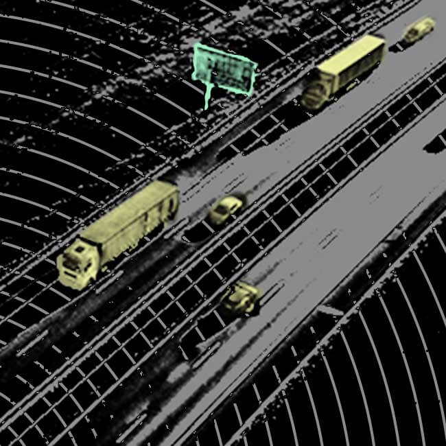
Lidar or 3D point cloud semantic segmentation is one of the key building blocks of autonomous technology, where a class label is assigned to each data point in the input modality.
iMerit delivers 3D point cloud annotation services that power AI, Machine Learning, and data operation strategies.

Lidar (Light Detection & Ranging) cameras are an essential sensor for geospatial technology, autonomous technology, and many other industry applications. Lidar utilizes lasers, scanners, and specialized GPS receivers to calculate distances to a given object. Annotating 3D point cloud data from Lidar cameras is a challenging and time-consuming task that requires specialized tools and an expert-level understanding of data annotation. 3D point cloud annotation can be combined with image annotation to train computer vision and other deep learning models to perform a variety of tasks.
iMerit experts are trained in annotating Lidar point cloud data and bring decades of individual experience processing thousands of data points. iMerit provides various Lidar data labeling services that cater to a client’s project needs including semantic annotation, 3D cuboid/box annotation, landmark annotation, polygon annotation, and polyline annotation. iMerit’s team provides a full-service annotation platform and builds custom automation processes for clients after calibrating their quality and throughput requirements.
Lidar or 3D point cloud semantic segmentation is one of the key building blocks of autonomous technology, where a class label is assigned to each data point in the input modality.
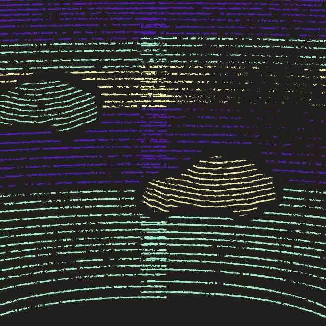
Fine-grained details can be captured through 3d point cloud annotation, allowing models to perform object detection and distinguish multiple 3d objects in a scene.
Lidar box labeling helps autonomous vehicles identify objects from 3D images. Through 3d Lidar sensor data machines learn to easily identify annotated objects instead of generalized ones within a given environment.
Lidar or 3D point cloud landmark annotation labels anatomical or structural points of interest to generate accurate datasets determining the shape of different sized objects, thus enabling machine learning algorithms to detect smaller images.
Lidar or 3D point cloud polygon annotations are suitable for training object localization & detection algorithms for objects like logos, signboards, and different postures of humans, with pixel-perfect polygons that are accurately drawn around the object of interest.
Lidar or 3D point cloud polyline annotation helps autonomous vehicles detect street lanes across roads on cities and highways. iMerit’s labelers annotate raw highways and city street data and images to make the road structure easily recognizable to self-driving cars.
iMerit subject matter experts will guide you through the process to develop a customized end-to-end workflow.
Transformative, solution-based approach. Interdisciplinary lidar annotation problem solving. Agility and responsiveness, Time-To-Value enhancers.
Targeted resources. Custom skilling. Focused and deep microlearning curriculum. Domain expertise. Rostering tools.
Alignment of lidar annotation tools and processes. Structured Development Milestones. Two-step production and QA annotation workflows.
Transparency via analytics. Real Time Monitoring and Service Delivery Insights. Edge case Insights. Dynamic Model Improvement.
Assessment of deliverable. Appraisal of key metrics, quality control processes. Model reconsideration. Analysis of business outcome.
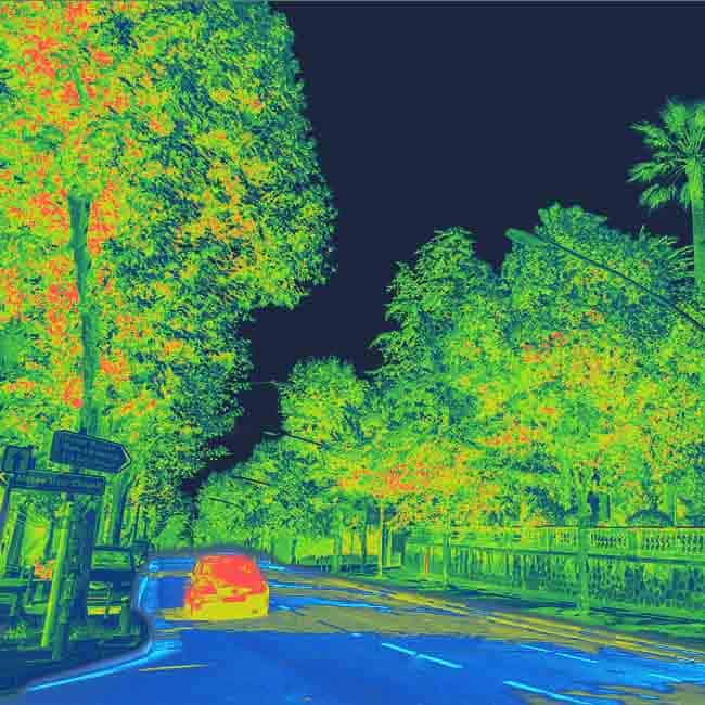
Client Profile: Leading developer of autonomous vehicles
Client data type: Street scene imagery
Challenge: Data annotation in the areas of pedestrian classification, headlight tagging, and driver behavioral prediction
Outcome: Working closely with the limited data on hand, iMerit experts annotated images using Lidar box labeling, a method that helps the machine to ‘see’ and understand the surrounding environment and react appropriately.
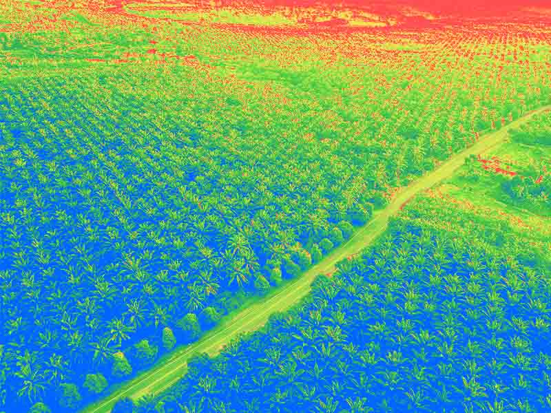
Client Profile: Top agricultural services company
Client data type: Lidar imagery of palm oil plantations
Challenge: Analyzing the proliferation of palm oil trees within a specific region.
Volume: Over 1 million aerial images
Outcome: Using LiDar, the teams classified the region into three specific layers of images: RGB, false color, and near-infrared. In just three months, this team successfully identified areas that were ripe for the planting of new palm oil trees.
The need for speed in high-quality Lidar annotation has never been greater. iMerit combines the best predictive and automated annotation technology with world-class data annotation and subject matter experts to deliver the data you need to get to production, fast.
Talk to an expert